Wednesday, December 8, 2021

12/08 - Sobrante Ridge


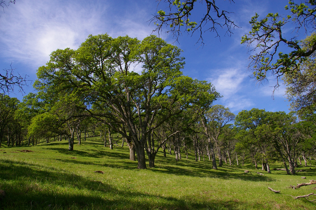
10 of us walked from the Coach Dr entrance up to the ridge and across to the Manzanita Hill Loop and back. It was an extremely foggy morning, very wet and drippy. But it was an enjoyable walk and one we hadn't done for 4 years. There is lots of death in the manzanita grove and evidence of new infections, but also lots blooming and seemingly surviving. About 2.75 miles.

"One of the most significant threats to pallid manzanita is infection by a soil-borne pathogen, Phytophthora cinnamomi, which causes root and crown rot in many woody species resulting in plant mortality within months of showing signs of infection." 
https://wildlife.ca.gov/Conservation/Plants/Endangered/Arctostaphylos-pallida

https://www.flickr.com/gp/momcat_ksw/0SMoMb for today's pictures


Wednesday, December 1, 2021

12/01 - Sibley


It was a very small group today, just 6 of us when Lynn walked up from Wilder to join us for a while. The day was pleasant, but very hazy so there were no long views. The main item of interest was the labyrinths which are scattered on the east side. We have often seen two of them, but Lynn pointed out two small ones on a ledge above the one in the deep quarry and said she had seen another off the main trail. Our route took us via an un-official trail north of the overlook to the southern end of Volcanic trail and another labyrinth I had never visited. Then we meandered further north to the overlook for the "heart" labyrinth. Lynn pointed out the trail which connects the Wilder development with the park.  About 2.4 miles for the five who started from the Skyline entrance; about 3.3 for Lynn.

https://www.flickr.com/gp/momcat_ksw/3yW3r7

Wednesday, November 24, 2021

11/24 - Mullholland Ridge


This was a short morning stroll on a lovely clear day before Thanksgiving. 9 of us followed the old Donald Drive past the EBMUD tank to the gate leading onto watershed land. Once we reached the lower tank, we took a single track trail around a knoll and then eventually thru another gate for the final bit up to the paved road. About 1.75 miles

We were all grateful for the green grass, the blue sky and the companionship of our walking friends.

https://www.flickr.com/gp/momcat_ksw/TkkrN3


Wednesday, November 17, 2021

11/17 - Mitchell Canyon


There were ten of us today on our first Mt Diablo hike since April. It was a beautiful fall day, crisp and clear and perfect for walking. There were still grapevines with colored leaves and the creek was flowing and making happy noises over the stones. We went as far as the picnic tables under the huge oak where we serenaded Monique (85!!) and had cookies before heading back.  about 3.75 miles

https://www.flickr.com/gp/momcat_ksw/H01970


Wednesday, November 10, 2021

11/10 - Tilden


There was a bigger than usual group today, fifteen of us plus 4 dogs, all glad to be out after the rain. We walked from the Inspiration Pt parking lot to the junction with the trail to the Rotary Peace Grove and then retraced our steps. About 4 miles.

https://www.flickr.com/gp/momcat_ksw/TQNTZa

Wednesday, November 3, 2021

11/3 - St Mary's College Museum


This was unusual and a bit more complicated than our usual outings. Susan and Geoff arranged a curator led tour of the Inuit Print exhibit at St. Mary's College Museum of Art. "Collective Memories: Stonecuts from Cape Dorset" is open to the public until December 12. https://www.stmarys-ca.edu/collective-memories


In the 1960s, graphic arts flourished at remote trading posts near Canada’s Cape Dorset region. This exhibition of selected stonecuts from the Saint Mary's College Museum of Art permanent collection reflects the collective memories and culture of Inuit peoples preserving stories and life experiences of seminomadic Canada through contemporary printmaking practices.

After the museum tour, some of our group walked to SiSi's coffee shop.

Just a few pictures this time.  https://www.flickr.com/gp/momcat_ksw/74i52G

Wednesday, October 27, 2021

10/27 - Canal Trail


8 of took advantage of a bright, post storm Wednesday to get out and move. With no idea what the weekend deluge had done to park trails, we stuck to pavement, starting from Rodgers-Smith Park on Grayson Rd in Pleasant Hill we took sidewalks to the Canal Trail crossing just east of Pleasant Hill Rd. The trail is generally north from there. We went as far as Taylor Blvd. At the end we made a loop thru Las Juntas Park. A bit over 3 miles.

https://www.flickr.com/gp/momcat_ksw/aX23w2


Wednesday, October 13, 2021

10/13 - Fernandez Ranch


Again, just 8 of us. It was a cool, cloudy morning very nice for walking; and the wind had died almost completely. We went up the Windmill Tr (the fireroad in the valley) to the gate on the saddle, then right along the Franklin Ridge Tr with wonderful views. We took the turn for the Canyon Loop Tr, then off on the single track Woodland Tr. This was the reverse of the route we took the first time we hiked this way in 2017 shortly after this section was opened to the public.  We had the Homestead Picnic Area all to ourselves for lunch. Just over 3.5 miles

https://www.flickr.com/gp/momcat_ksw/068358

Wednesday, October 6, 2021

10/6 - Pine Canyon


 It was a cool gray day to start and very pleasant for walking. We were a small group and seemed to stay together more than has often been the case. The grape leaves were mostly green, the poison oak red or leafless; most of the colors were very soft. A very nice 3.5+ mile hike. One difference from our earlier visits - we returned to the cars via Castle Rock Tr (starting at the gate just north of the sharp u-turn in the trail) rather than along the main entrance road. It was about the same length and deposited us right at the cars.

https://www.flickr.com/gp/momcat_ksw/LU93Fs


Wednesday, September 29, 2021

9/29 - Wildcat Canyon


Delia and John Taylor were our leaders today. The route was an out and back of just under 4 miles along the Wildcat Creek Tr from the Alvarado staging area off McBryde Ave. That took us halfway to Jewel Lake in Tilden

It was a largish group (12) and would have been larger if not for an unfortunate start to the day for Phred and Elaine. They misjudged the entry to the parking lot and ended up with 3 punctured tires from the tire spikes at the poorly marked entrance. This required a flatbed tow truck from AAA and an expensive visit to Les Schwab in Martinez

https://www.flickr.com/gp/momcat_ksw/t30100 for pictures.

The walk started on pavement and Delia told us that at one time a development of 3000 homes was planned in the canyon. Read about it at http://www.friendsofwildcatcanyon.org/?page_id=55

And Gayl half remembered something about an even earlier history of the area. In 1914 a sanitarium opened here. If we had know more detail, the site would have made for an interesting side trip as it is only about 1/4 mile up the Belgum Trail. There is not much left as the house was burned by vandals in the 1970s. Read about it at

https://brokeassstuart.com/2018/03/22/hidden-east-bay-wonders-ruins-of-the-belgum-sanitarium/


Wednesday, September 22, 2021

09/22 - Chabot


The intent was to start from the upper bend on the road on the hill to the east of the marina. Turns out it is closed except for service vehicles, so we defaulted to parking along the road and walking the east shore trail. Thank goodness for cell phones as I reached everyone and we managed to meet. Bit by bit members of the group pealed off and in the end it was just Lee, Ed and I who made the 4 mile walk. Very dry, but not as dusty as Redwood was last week. And the promised cool down wasn't as much as had been promised, so it was over 80 by the time we returned to our cars. Still it was good to be out and moving and have time to talk with each other.

https://www.flickr.com/gp/momcat_ksw/qzTh58

Wednesday, September 15, 2021

09/14 - Redwood Regional Park


There were a dozen of us today plus Oscar and Sunny. We made a loop from the Skyline Entrance to Redwood RP, following the West Ridge Tr to Tres Sendas, then down to Stream Tr and back up to the parking lot. We started in dense fog and ended with sunshine and bright blue sky. Shirley sent chocolates and Susan baked cookies to celebrate three birthdays (Sylvia, Karen and Martha). Even tho the trails are quite dusty and everything is terribly dry, a  good time was had by all. Under 3 miles.

https://www.flickr.com/gp/momcat_ksw/7YmLR8

Wednesday, September 1, 2021

9/1 - Briones


A nice group today: 14 for the hike (plus Oscar and Sunny)  and then 17 for lunch and a party to celebrate Jack's 90th Birthday (today!!). We huffed and puffed up the Briones Crest Tr and then returned via the Deer Creek Tr. It was under 3 miles but we all felt that we earned our cookies!

https://www.flickr.com/gp/momcat_ksw/67d8fQ

Wednesday, August 25, 2021

08/25 - Wildcat Marsh


A good group today...We all circled the "mountain" with Susan, Elaine and Gayl taking the Upper Trail and the rest of us following the lower loop trail. We started in fog and ended with bright sky and a light breeze. Just under 3 miles

As we were getting into cars to leave a fellow came up and introduced himself as the Republic Services site manager. He told us a lot about the way the site had developed and how they are attempting to maintain it in a responsible fashion. The large, low-lying central area is a retention pond for storm water and has no connection to the Bay. The landfill opened in 1953 and was "sealed" in 2010. Now the only additions are green waste which is added to the "garbage mountain"  as a cap.

Most of the plants we saw along the trail were non-native, some from the green waste additions, some from birds. This is probably better walked in fall/winter when the migratory flocks are visiting, but there were lots of seagulls, some egrets and pelicans, and little birds which departed just as one got them spotted with binoculars. All in all a very pleasant morning.

https://www.flickr.com/gp/momcat_ksw/5m66FD

Wednesday, August 18, 2021

08-18 Miller-Knox


Heavy, smokey haze meant we didn't have much of a view today, but 10 of us (including Ulla for the first time since late June) did enjoy exploring. The trail map is deceptive as the trails are mostly quite rough and not as well maintained as they could be. We were aiming for the "False Gun" installation on the top of the ridge, but never made it that far. After returning to the flat area we went out to the old Sante Fe ferry terminal and then back to the cars. Only a bit over 2 miles but the up and down made it feel like more.

https://www.flickr.com/gp/momcat_ksw/hCkyyz

Wednesday, August 11, 2021

8/11 - Tilden


This is a hike last done in 2005! (at least as nearly as I can tell from the spreadsheet). We started from the parking lot where we usually start our Strawberry Canyon hikes. The trail is moderately up on the eastward walk, then down and eventually moderately up returning to the start. There was enough shade and an occasional breeze to keep us comfortable. The original plan was to take Grizzly Peak trail to Tower trail and that down to Golf Course trail. One look at the steep, narrow, leaf filled rut of the Tower trail led us to extend the hike a bit and circle back around the Gillespie Youth Camp. All very well, but the trail markings are rather sparse and finding the trail past the facilities took some guessing. The 2.5 miles was plenty and we were glad to be back before noon.

Consensus is that this is a keeper. Lots to look at even with all the dryness. Not a difficult walk and some really pretty sections. All the preventative logging is in other areas. And there was a nice grove of redwoods just as we got almost to the cars. A real drop in temperature once we were in their shade.

https://www.flickr.com/gp/momcat_ksw/Y2L32r

Wednesday, August 4, 2021

08/04 - Huckleberry


It was a very foggy, almost drippy, morning as 8 of us started from the Skyline Gate Staging area for Redwood RP. We followed the Bay Area Ridge Tr segment across Pinehurst Rd and into Huckleberry Preserve. There we stayed right and made a CCW loop thru the preserve, returning the way we had come. By noon the sky was mostly blue, but there was still a foggy freshness to the breeze. About 3.5 miles

https://www.flickr.com/gp/momcat_ksw/7vC5aN

Tuesday, July 27, 2021

Caples Week 7/18-7/23


This year's week at Caples started with multiple sources of stress. First was the uncertainty of what would be growing given the terribly dry weather. Second was the explosion of the Tamarack fire just as we were due to arrive; how would the fire move, what would the smoke situation be like, etc.. Then there were health issues with some of our friends (Ulla was in the hospital, Susan came up late as Geoff was not well, Ron and Sylvia stayed home at the recommendation of his doctor).

But the week turned out to be wonderful. Mostly we were without smoke, there was lots of food and plenty of good conversation in the evenings after hikes which had plenty to look at. Our timing was good, too as the wind direction changed Friday morning and the smoke filled the basin.

I took over 800 pictures and promise you that I tried very hard to keep the number of them posted under control!


7/18
Donita, Phred, Elaine and I walked from the parking lot at Red Lake up as far as the cliff where the rock fringe grows. It was very dry for the most part, but there was still some water in the usual spots. Most of the flowers we expect were well past their prime, if not completely finished blooming. Up in the dry slide area we were lucky to see the Blazing Stars for the first time in several years. And there were plentiful butterflies. The most impressive sight, tho, was the building pyrocumulus clouds to the east. The sky overhead grew inky dark as the afternoon progressed. Altho it had been clear at Caples at noon, it was very gray with a combination of smoke and clouds by the time we returned and only Black Butte was visible to the SSE.
https://www.flickr.com/gp/momcat_ksw/106rb5


7/19
We met at 8:30 and four high clearance vehicles took us into the Schneiders Camp trailhead. Here there were plenty of flowers!! Judy returned early as the altitude was bothering her. Phred wandered about taking pictures. The rest of us made it to the ridge and then Elaine, Polly and I turned around while the rest went on to the spot where you can look down on Showers Lake. Cynthia soon returned to join the three of us. We were back to Caples by 2:30. I was just out of the shower when the thunder started. Returning to the room I had to shut the window as the rain was blowing in. The other hikers did get a bit damp as they were still on the trail when the showers blew through. We learned later that some of the lightning started another fire about 3 miles south of Kirkwood in the Mokelumne Wilderness. The picnic tables at cabin #5 were dry for supper and we celebrated Polly's 88th birthday two days early.
https://www.flickr.com/gp/momcat_ksw/LPm621


7/20
This was the Woods to Winnemucca day. Ten of us started together, but soon spread out along the trail as some were botanizing, some taking pictures and some both and/or just slow. Hikers we met who were not familiar with the norm for that area were enthusiastic about the flowers, while we kept thinking of what we weren't seeing. The most obvious thing was the lack of almost any snow on  Round Top and none at Winnemucca. However there was still outflow from the lake. Among the flowers we did not see were Labrador tea, Marsh marigold, Ipomopsis, Penstemon newberryi, P. speciosus, the Triteleia ixioides (Pretty face), and lots of the tiny flowers which are such hidden treasures.
Cynthia, Polly and I returned the way we came. The others made the circle up to Round Top Lake and down the Mines Trail. Everyone was tired that evening. The good news was that Susan arrived just at supper time.
https://www.flickr.com/gp/momcat_ksw/Hkx5Z1


7/21
There were several separate groups on Wednesday. Lee, Chuck and Robin went to Lake Margaret. They saw the white Gentiana newberryi in the area between the two outflow creeks from Caples! Judy didn't hike, Susan took a walk along the lake and back via the old road to the north of the current highway and so into the campground. Donita, Cynthia, Polly and Karen took the trail up to the Meiss Col and then followed the unmarked trail up the ridge to the spot we call the "hidden garden". It started out clear and breezy with temperatures in the 70s. There was some smoke in the distance from theMokelumne Wilderness (Summit) fire. Around noon billows of smoke appeared from the Tamarack fire. There were several helicopter over flights during our time on the ridge. We went up the usual way, leaving the PCT before the pond and following the posts up the ridge. On the exposed slope everything was very dry and very little remained in bloom. But we did find enough to make the effort worth while. We cut down to the north end of the pond where Lee reported she had seen Elephant's heads and tiny yellow Mimulus.We rejoined the PCT and returned the way we came. When we arrived in the morning there was only one other car in the usually packed lot; there were a total of 4 when we returned.
https://www.flickr.com/gp/momcat_ksw/Gfc1xX


7/22
For our last day Susan, Judy, Polly, Cynthia and I hiked up the old Hwy 88  route from Red Lake clear to the overlook parking area where we left a shuttle car. Conditions were much the same as they had been on Sunday, but because it was morning rather than afternoon we saw things differently.
https://www.flickr.com/gp/momcat_ksw/9v7g44


miscellaneous
This bunch includes pictures from around Caples Lake, from the birthday celebration for Polly, and a few from the drive home.

https://www.flickr.com/gp/momcat_ksw/9FhEST


Enjoy!


Wednesday, July 14, 2021

7-14 from Rancho Laguna Park


Ten of us met at Rancho Laguna Park in Moraga and walked south west to San Leandro Reservoir. It was a bright and breezy day after morning fog. Not too hot in the sun, but the shady parts were welcome. It is very dry and the reservoir quite low. There were numerous birds and even a sighting of a family of wild pigs. Just under 3.7 miles

Wednesday, July 7, 2021

7/7 - from end of Springhill Rd


There were 8 of us today. The fog was just lifting as we started out and the breeze was cool. We walked out the canyon, crossed and doubled back and climbed partway up the connection to the Sunrise Tr. Six of the "bears" went up to the first big bend to see what we could see on the other side of the mountain. Then we all descended and retraced our steps as far as the canyon crossing, then went further up the canon and circled back to the other side. Warm in the sun and cool in the shade. It was a nice way to get out and about. (3 miles)


https://www.flickr.com/gp/momcat_ksw/350DdT

Wednesday, June 30, 2021

6/30 South shore of Briones Reservoir


There were just 5 of us today on a bright, but cool, almost fallish feeling day. We walked from the EBMUD parking lot on Bear Creek Rd to the Dam overlook parking lot where Shirley met us to shuttle drivers back to the start. There was lots to look at in spite of the extremely dry conditions. A very nice walk, just a bit over 3.5 miles.


https://www.flickr.com/gp/momcat_ksw/gJfGxj

Wednesday, June 23, 2021

6/23 - chabot


For the first time in at least 5 years we started from the Bort Meadow's entrance on Redwood Rd for our walk in Chabot regional park. 9 of us started in the fog but by the time the hike ended it was a bright breezy day. We walked clockwise out the Grass Valley Tr as far as the stone bridge and then back Brandon Tr to Bort Meadows where we ate our lunch. There was a lot to see and all agreed it was a good hike.  3.6 miles

https://www.flickr.com/gp/momcat_ksw/6J0kbb

Wednesday, June 16, 2021

06/16 - Skyline Gardens to Sibley


A heat wave forecast meant it was better to start early (we were on the trail by 9) and chose a route with shade and mostly downhill. The hike from the Steam Train parking lot to the Tunnel Rd entrance to Sibley fit the bill. There were just six of us which worked well with a shuttle back to the cars (thank you, Shirley!!). All agreed it was much more interesting than we anticipated and since we were done by 11, the temperature, tho above normal, wasn't stinky yet. Just over 2 1/2 miles.
https://www.flickr.com/gp/momcat_ksw/kLM47q

Wednesday, June 9, 2021

6/9 - Briones east side


Just seven of us on a bright and breezy day, cool for June. We started from the Reliez Valley trailhead and headed west toward the hills. As far as I can tell the Wednesday Walkers have not walked in this part of Briones. The original plan was to take a lollipop route: out Blue Oak Tr, up the canyon on Blue Oak Shortcut, and back down Blue Oak Tr. The trail was steeper than we wanted to tackle both the single track up the canyon and the fire road coming down, so we made it an out and back. It was very dry, but most of the oaks were in good condition and there were interesting things to see once we were into the canyon About 2 3/4 miles

https://www.flickr.com/gp/momcat_ksw/dCEa9A

Thursday, June 3, 2021

06/02 - Tilden


Just 9 of us met at the parking on Lone Oak Rd in Tilden on a cool morning, foggy to start, but perfect for walking. We went up the Loop Rd, took the single track Sylvan Trail around and down to Jewel Lake, meandered close to the water for a bit then picked up Upper Packrat Tr. Delia was right, there was a great deal to see and we were constantly stopping to examine something or other. Once back to "civilization" we found a picnic table for our lunch, then walked the quarter mile remaining to the cars. Not very long 2.25 miles, but very pleasant and unexpectedly interesting.

https://www.flickr.com/gp/momcat_ksw/P52dR6


Wednesday, May 19, 2021

5/19 East side of Mt Diablo


Nine of us took advantage of cooler weather (high 60's) to visit the NoEast side of Diablo. It was a windy day, but lovely to be out on the trails. We started from the Mitchell Canyon trailhead, taking Oak Rd, then down to Murchio Rd, Bruce Lee Rd to Back Creek Tr, then up the canyon to the junction with Tickwood Tr and in a quarter mile, Donner Cabin Tr further east and down to the Donner Cyn Rd; Donner Cyn to Murchio Rd which we took all the way back to Watertower Rd and then back to the cars.

Susan had suggested Back Canyon and Tickwood Tr, but trying to design a shorter loop than what we have often done led to the trial of Donner Cabin Tr. It would be hard going up, but down was fine and even Susan said she had never walked it.

https://www.flickr.com/gp/momcat_ksw/W0Z582


Wednesday, May 12, 2021

5/12 Pt Pinole


After days of heat and dry wind in the interior East Bay, the choice of Pt Pinole was a good one today. It was bright and breezy and the wind off the fog made the sun feel good. Eight of us walked a clockwise loop from the Atlas Rd entrance, making a detour out the fishing pier, for a distance of a bit over 3 miles. It is so very dry!  There are few flowers and the ones there are are smaller than usual.

https://www.flickr.com/gp/momcat_ksw/93htW7


There was no hike last Wednesday - too hot.

Wednesday, April 28, 2021

4/28 Fernandez Ranch and 4/21 Donner Cyn

 4/28 Fernandez Ranch


Nine of us and two very well behaved dogs enjoyed the quiet of Fernandez Ranch on a warm, bright day. Things are getting terribly dry and open areas were "crunchy" under foot. Luckily this loop has lots of shade and most of the sunny bits are downhill. Under 2.75 miles

https://www.flickr.com/gp/momcat_ksw/8F26A7


4/21 Donner Cyn


It was a small group today, just 8 of us. But it was a glorious day to be out on "our" mountain. We parked and the end of  Montaire Pkwy and headed out Donner Canyon. Then we took Heatherington Tr from the creek crossing by the Donner Cabin site, Donner Tr, a bit of Wasserman, Bruce Lee Springs and finally Clayton Oaks. We had lunch on a shady bank up on Clayton Oaks Rd. There were some very good flowers as well as a reminder of how dry the winter has been and how stressed much of the plant communities are. But it was nice to have easy creek crossings :-). About 3.75 miles

https://www.flickr.com/gp/momcat_ksw/xV7v0g

Wednesday, April 14, 2021

4/14 - WCOS Shell Ridge


We were a small group today. We started by exploring the volunteer garden/eco-restoration at the Sutherland Dr  entrance to Shell Ridge. Jeanne and Lynn joined us for that part of the outing. The majority of the flower pictures are from this area (for background see: https://wcosf.org/projects/sutherland.html)

Leaving the garden area we made a long lollipop along the Indian Creek Tr to the Joaquin Ranch Tr, a short bit of street and then up to the Briones-Mt Diablo Tr and back. Altho we stared as 9, there were only five of us for first trail lunch in over a year at one of the memorial benches along Indian Creek. Just under 3.5 miles
.

https://www.flickr.com/gp/momcat_ksw/K4oz75

Thursday, April 8, 2021

3/7 - Briones


We started from the parking area at the end of narrow, twisty Briones Rd, took the single track down to Pine Tree Tr and then turned East on Toyon Tr. There was a bit more down before a long up hill to meet Lagoon Tr.; across the open area by the Maricich Lagoons and down the Old Briones Rd to complete the loop. I had never walked this loop counter-clockwise and it was interesting to see things from the different perspective it provided. There were lot of different flowers, just not as tall or lush or as many individuals as we are accustomed to seeing given the very dry winter. Still I took over 100 pictures. 3.5 miles


3/31 - Perkins Cyn


There were 13 of us today. The group rapidly separated into smaller sub-groups and after the first half mile we were never all together again. It was a very warm day (high 70s); the ambling progress suited the day and there were lots of flowers. The good news for me was verifying the connection between the trail which heads up the steep slope section of the Perkins Tr (which eventually connects to Ray Morgan Rd), and the single track trail which leads past the dams. Mileage varied widely but was not more than 2-3 miles.


Monday, March 29, 2021

3/24 - Round Valley Regional Preserve


There were a dozen of us today. We all started together walking out Miwok Tr. Susan, Geoff, Monique and Polly left the rest of us at the junction with the Hardy Canyon Tr which they took for their return route. The rest of us walked on into Round Valley and then out the Fox Tail Trail, returning the way we had come. The Deer complex fires of last September burned into the Preserve, but we saw little evidence at close range. However the steep slopes which form the eastern edge of Morgan Territory preserve were obviously affected.

The map is approximate as we often left the fire road trail to follow parallel cow paths along the creek course or thru the woods. Map distance was 4.7 miles (approx) for the main group and 4.5 miles for the smaller group, but they had _much_ more elevation gain.

https://www.flickr.com/gp/momcat_ksw/6Se16f

Wednesday, March 17, 2021

03/17 - Pine Canyon


There were 10 of us on a cold (42 when we started out)), gray day before a  promised storm. We did the usual out-and back going as far as the boarder with Mt Diablo St Park. John added on mileage from there, but the rest of us turned around and retraced our steps. It is very dry; the grass is short, flowers sparse and creek beds empty. Still everyone was glad to be outside and together. The light was soft and the green was just right for St Patrick's Day. A bit over 2.5 miles

https://www.flickr.com/gp/momcat_ksw/2E09Qf


03/10 - There was no hike; rain and wind kept us home.


Wednesday, March 3, 2021

03/03 - Lime Ridge


There were 11 of us today on a very gray day at Lime Ridge. It was green, but the grass was very short and everything quite dry. We had hoped to return via the Ridge Tr, but the whole area is closed for habitat restoration, so we returned via Manzanita, Bcukeye and Ohlone Tr. 2.75 miles (John added several more miles on his own).

https://www.flickr.com/gp/momcat_ksw/88q6N4

Wednesday, February 24, 2021

2/24 - Black Diamond Mines

It was a bright, pleasant morning with increasing winds. The 13 of us, plus 3 dogs, were headed back to the cars before it got too nasty tho. We all walked up Chaparral Loop and Manhattan Cyn to the gate on the fire road. We even started back together past the Indian Warriors and the large sandstone cliff, but some picked up Manhattan Cyn where it joins the road while the larger group followed the fire road up and down until it met the Nortonville Trail above the cemetery. Just under 3 miles for most of us (John took off on his own for a longer hike).

Altho we did see some flowers, there were not many and most were very small; we feel it is the result of our dry winter. The grass is quite short for late February, 6" or less. The Park district has been cutting many of the invasive Ailanthus altissima (Tree of heaven) along the Nortonville Rd and were busy chipping as we passed by. We also saw a number of buckeye seedlings, planted and caged, in the same area. No sign of goats or sheep this year.

https://www.flickr.com/gp/momcat_ksw/gc5258

Tuesday, February 23, 2021

2/17 - Crockett Hills


Well masked and distanced 7 of us met at Crockett Hills. We made a short 2.3 mile lollipop loop. Trails were fine even tho it rained most of the day Monday and we anticipated slippery mud.  The Dirca was in full bloom along Wood Rat Trail. Altho we knew where to look for the Oso berry, all we found were leaves. And the white flowered ribes had only the tiniest of buds. But it was wonderful to be back on the trail with friends on such a glorious, blue sky-spring green morning.


https://www.flickr.com/gp/momcat_ksw/2AM337