Saturday, December 29, 2018
12/28 - Soup Day
A lucky thirteen of us walked up from Saklan Indian Dr to the labyrinth on the east ridge of Rossmoor. After pacing the labyrinth, Jeanne and Polly drove back to Jeanne's to heat the soup and greet Juanita, while the rest of us meandered back on foot (1.5 mile).
If you are interested in the Tice Rock history, see:
www.rossmoornews.com/wp-content/uploads/2015/03/RMN-03-04-15.pdf
It was a glorious winter day; a fitting end to the 2018 hiking adventures of the Wednesday Walkers.
https://www.flickr.com/gp/momcat_ksw/3tH6y4
Wednesday, December 19, 2018
12/19/2017 Lafayette Moraga Trail
A very foggy, dark day saw 10 of us walk along the Lafayette-Moraga Trail from the old OSH lot as far as the waterfall and back. There was a detour through the old walnut processing site which is now the home of the Moraga Gardens Farm (https://moragagardensfarm.org/). We stopped into SiSi Cafe for coffee afterwards. A bit over 4 miles.
https://www.flickr.com/gp/momcat_ksw/1zBk1R
catching up...
12/12/2018 - Lime Ridge (I didn't hike)
12/5/2018 - Holiday lunch ant Sylvia and Ron's
11/28/2018 - No hike, rain
11/21/2018 - No hike, rain forecast
11/7/2018 at Pt. Pinole
13 of us (and Oscar) enjoyed a bright, mild fall day at Pt Pinole. We reversed our usual direction and walked a counter-clockwise loop of about 4.4 miles. First we explored a short spur along San Pablo Bay past the black powder press, then headed out to the fishing pier. Lunch was at the tables in the eucalyptus grove before heading back along the west side of the park (Bay View Tr, Giant Station, Cooks Pt).
https://www.flickr.com/gp/momcat_ksw/2zwCt3
Friday, November 16, 2018
11/14 - No Hike
![](https://blogger.googleusercontent.com/img/b/R29vZ2xl/AVvXsEiGsoF9uUqcYwWIMb_xHNtd6k0K6LbCF_0hmoXvXUq5-JydIsgab7yx1AI-MdAp5sVuMcPAOB5NLCEOno1krtKkd8XqeAZLTRQiXqZkfOArONV6o34mOyx7S7N3U8BibaBk60ck7XkiWy1h/s400/Screen+Shot+2018-11-16+at+6.03.07+AM.jpg)
Hike cancelled due to smoke from the Camp Fire in Butte Co.
The image from NASA shows the smoke spread on Wednesday:
https://earthobservatory.nasa.gov/images/144245/camp-fire-still-raging-in-california
Wednesday, October 31, 2018
10/31 - Briones
There was a big group (15 + Oscar and Mojo) today. We took Old Briones Rd up to the Briones Crest Tr, down to Valley Tr and returned. The group separated into two for our early lunch stop...some in the shade with a northerly view on Briones Peak, the rest in the sun overlooking Walnut Creek with Diablo in full view. It is very dry, but it was a lovely fall day and we all enjoyed the walk which ranged from 4.6 to 4.9 miles.
https://www.flickr.com/gp/momcat_ksw/hs9H31
Friday, October 26, 2018
10/24 - Mt Diablo
Only 2.6 miles, but lots to see and enjoy, especially the spectacular displays of colorful grape vines.
Apologies if names aren't current. I had to use my old print copy of Jepson as there were internet service problems and I couldn't reach CalFlora or Jepson eFlora.
The pictures are a bit different today as I found the batteries were dead in my camera as we started out and had to use my phone camera. As this is a fairly new one, I wasn't sure what the results would be...lots of multiple exposures, several videos and a few other oddities, but enough usable ones to give you an idea of what a beautiful day we had on "our" mountain.
Wednesday, October 10, 2018
10/10 - Las Trampas
13 hikers and Oscar made a 3.5 mile loop from the end of Camille Ave in Alamo up Madrone Tr in Las Trampas Regional Wilderness and down Ringtailed Cat Tr to the Hemme Av trailhead, then surface streets and the Iron Horse Tr back to the cars. It was a long "up" followed by a steep "down". But it was a beautiful fall day and we were glad to be on the trail.
https://www.flickr.com/gp/momcat_ksw/L35J61
An interesting coincidence...we hiked this route exactly 5 years ago on 10-9-2013 (pictures of that hike at http://flickr.com/gp/momcat_ksw/7dM9PV/)
Wednesday, October 3, 2018
10/03 - Huckleberry Preserve
There was only a small group (6) today. For the first time in three years we made the Huckleberry loop starting from the Pinehurst Gate. It is a short hike, about 2.7 miles, but feels longer due to the elevation changes. This time we went around the loop clockwise which seemed easier. Early lunch at the Manzanita barren. The hike ended on an up note...look for the surprise at the end of the pictures.
https://www.flickr.com/gp/momcat_ksw/NgC9DX
Wednesday, September 19, 2018
9/19 - Tilden
It was a big group today, including Delia who has not been hiking for quite a while and Charlotte who had been on a cruise to Alaska; 15 plus Oscar. With the weather warming, we hoped for some shade and breezes along with views from Seaview Tr. Shade we got, but it was very hazy so views were not great, especially to the west; breezes were almost non-existent. We had lunch in the shade at the junction with Lower Big Springs Tr. and took that down to So Park Dr. Drivers were shuttled back to the cars at the Steam Train parking lot. Just under 3.5 miles
https://www.flickr.com/gp/momcat_ksw/Y5171F
Thursday, September 13, 2018
09/12 - Pine Canyon
Only 9 of us today, but it meant we could all sit at one table for lunch. It was only 10:45 when we reached the gate leading into Mt Diablo St. Park, so we kept going for another half hour before returning to the planned lunch spot just back into the Diablo Foothills Regional Park. The grape vines were only beginning to show color, but the poison oak was fully red. It is a good trail and altho there were other hikers, it is always a quiet and very peaceful place. A good walk on a warmish early fall day. About 4 miles.
https://www.flickr.com/gp/momcat_ksw/9zExc7
Wednesday, September 5, 2018
09/05 Lake Chabot
A dozen people and two dogs (Oscar came with Ron and Sylvia & Bob brought Bacchus) visited Lake Chabot. We walked the Eastshore Trail to the bridge and then went further up Cameron Loop, then back to the little trail which parallels the main trail and wanders thru the flood plain to find a spot for an early lunch. Finally there was the long tromp back and a stop at the snack shack for ice cream. Susan and Ulla each added additional distance by completing the Cameron Loop, Susan CCW and Ulla clockwise. 5.25 miles for most, 6 for the two adventurous ones.
https://www.flickr.com/gp/momcat_ksw/DM85j8
I didn't realize how much I depend on calflora until it was unreachable this afternoon. But I found helpful plant lists on the EBRPD website; one a district wide checklist and others specifically for the individual parks. Why didn't I know this sooner? http://www.ebparks.org/about/stewardship/plants/checklist.htm#District
Wednesday, August 22, 2018
8-22 Chabot RP
Eleven of us did a "new" hike...well, most of it was new to us. We started at the Chabot Equestrian Center on Skyline Blvd. and walked generally north along Goldenrod Tr to Ranch Tr. which took us down zig zags to the valley. Then we followed Grass Valley Tr to Bort Meadow for lunch and walked up toward Redwood Rd where we picked up McDonald Tr to take us back to Parkridge Dr. where Shirley's car was waiting to shuttle the drivers. Distance about 4.3 miles
We have walked the McDonald Tr from Parkridge in the past, but never done Goldenrod or Ranch Tr. Very few people out on a nice day for walking.
https://www.flickr.com/gp/momcat_ksw/S616D6
Wednesday, August 15, 2018
8/15 - So Shore Briones Reservoir
A dozen of us walked the 3.56 miles from the parking area at Bear Creek Rd, along the south shore of Briones Reservoir to the parking area at the dam. A hazy day, but not too warm and there was plenty of shade. Shirley's car was at the dam lot and she drove back for the other drivers. After collecting the hikers we headed to Briones Park for lunch. We really enjoyed watching hawks hunting for their lunch as we ate ours.
https://www.flickr.com/gp/momcat_ksw/vE9HsF
Wednesday, August 8, 2018
8/8 Joaquin Miller Park
With very poor air quality from the smoke and warm temperatures forecast, we headed west of the hills hoping for both better air and cooler temps. The air was not bad and the temperature was fine for our morning walk.
This was essentially the same walk we did on 8-31-16, the last time we walked here. Starting from Joaquin Miller Court off Mountain Blvd., we went up Palo Seco Creek (Palos Colorados Tr), looped out to Lookout Point for an early lunch after walking out to the Joaquin Miller pyre, and returned to the cars down Sinawik Trail and a few blocks through the neighborhood, followed by a straight shot along Mountain Blvd. About 2 3/4 miles.
https://www.flickr.com/gp/momcat_ksw/7590h4
Wednesday, August 1, 2018
8/1 Tilden to Sibley
It was nice to be back on the trail after last week's heat and all the smoke form the various wildfires.
14 of us started from the steam train parking lot off Grizzly Peak. This is the segment of the Bay Area Ridge Trail that includes the "Skyline Gardens" - 170 native plant species are found along a mile-and-a-quarter of trail. We were right on the edge of the fog which made for very pleasant walking and beautiful light. Shirley's car was parked at the end of Fish Ranch to shuttle drivers back up the hill after our early lunch/snack. Only 2.5 miles, but it felt like more.
https://www.flickr.com/gp/momcat_ksw/yAmtBF
Wednesday, July 18, 2018
07-18 Joaquin Miller/Roberts Recreation Area
14 hikers plus Oscar enjoyed the shade at Joaquin Miller and Roberts Recreation Area. We walked up the Sunset Trail, then the Chaparral Trail, crossing Skyline Blvd, passing the Rotary Camp area to Roberts Ridge Trail, and making our way through the woods near the navigation trees monument. An early lunch was followed by the downhill return via Big Trees Trail. A bit over 3 miles, round trip.
https://www.flickr.com/gp/momcat_ksw/T7oh6n
Tuesday, July 17, 2018
Caples Week July 8-13
As usual it was a wonderful get away. We had almost perfect weather (a bit windy and Tuesday was quite warm) with no significant clouds until the last of us were due to leave on Friday morning. The company was congenial, the food much more than adequate and the flowers outstanding.
Sunday
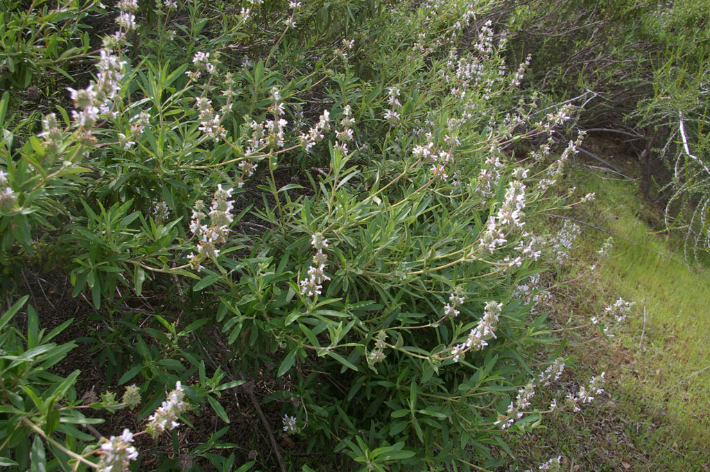
The trip up rates two albums. First the Mormon Emigrant Trail section with all the wonderful washingtonia lilies for which Lee had been kind enough to provide mileage locations; then a stop at the big Leek Springs meadow.
https://www.flickr.com/gp/momcat_ksw/tc8n9v
We met Nick and Jeanne at Red's Lake for a gentle acclimatization hike up the old Hwy 88 grade and also made a visit to the pioneer monuments at the top of the grade.
https://www.flickr.com/gp/momcat_ksw/LDeys3
Monday
We were lucky to have a sufficient number of high clearance vehicles this year so took advantage of that to drive in to Schenider's Cow Camp and hike from there to the ridge. Part of the group continued on toward Little Round Top (Chuck went all the way). The flowers were dense and spectacular!
https://www.flickr.com/gp/momcat_ksw/6Z255y
Tuesday
Almost all of us headed to Winnemucca starting from Woods Lake; Ron and Sylvia opted to do the hike to Meiss Col instead. Lee, Chuck, Judy and Donita made the circle up to Round Top Lake and back to Woods via the Lost Cabin Mine Tr. but the rest of us turned it into an "up and back"
https://www.flickr.com/gp/momcat_ksw/E94LW7
Wednesday
Most folks headed off after breakfast. Only six of us were left: Donita, Ellen and Jane in cabin 2 and Judy, Ulla and I in the lodge. We all made the hike up to Meiss Col but once past the pond separated, with the cabin 2 folks returning to their car and heading down to Blue Lake; Judy and Ulla going as far as the Meiss cabin; and Karen snooping about on the plateau. We saw more calochortus this time than ever before and Lee and Chuck had seen the peony and gave us clear instructions on finding it.
https://www.flickr.com/gp/momcat_ksw/To163C
Thursday
Just the lodge trio was left for a last day of hiking. We went up to the "Two Sentinels" starting from the Thunder Mountain trail head. It was very dry and dusty, but the views were spectacular.
https://www.flickr.com/gp/momcat_ksw/1DA526
Misc at the Lake
A few miscellaneous pictures (postcard type <g>)
https://www.flickr.com/gp/momcat_ksw/g9C796
Friday
Judy left first as she needed to be to to Rossmoor by lunch time and wanted another shot at the lilies. Ulla and Karen were off by 8 and enjoyed exploring a dirt road we had spotted above the Leek Springs meadow. The Delphiniums we found were worth it, and we stopped for more lily pictures as well.
https://www.flickr.com/gp/momcat_ksw/46W8fj
Wednesday, June 20, 2018
06/20 - Tilden
There were a dozen of us on this leisurely walk from Laurel Picnic Area to the Botanic Garden (2.5 miles). There were plenty of flowers along the trails and some wonderful things in bloom in the Gardens. It was a good way to celebrate Ron's birthday!
https://www.flickr.com/gp/momcat_ksw/B90nad
Thursday, June 14, 2018
6/13 Ring Mountain Preserve
Thirteen on 2 legs + Oscar the dog headed to Marin hoping to escape the inland heat. Perfect weather for a leisurely walk at Ring Mountain. We found the special Calochortus and the Silene, were overwhelmed by the amount of Clarkia and Triteleia, and generally felt that, tho short on distance (under 2.5 miles), we were amply rewarded with flowers and views.
https://www.flickr.com/gp/momcat_ksw/035iCf
Wednesday, June 6, 2018
6/6 - Treasure Island
A big group (26?) enjoyed our annual luncheon and thank you to Shirley at Mersea restaurant on Treasure Island. We arrived about 10 and most walked the Perimeter Rd as far as the north east corner and back; some made a circle on surface streets. Others stayed closer to the restaurant. It turned into a lovely day, a bit hazy but bright and with little wind until we were leaving. Marvelous views and lots of good fellowship.
https://www.flickr.com/gp/momcat_ksw/08x3Xk
If you missed the pictures from the preliminary scouting expedition in April (it was slightly clearer that day and there were other flowers) see:
https://www.flickr.com/gp/momcat_ksw/y13zvC
Thursday, May 31, 2018
5-30 Fernandez Ranch
After a 90 degree day on Tuesday, Wednesday was at least 20 degrees cooler with a good bit of biting wind. A year ago, 6-14-17, we hiked the newly opened northern section of Fernandez Ranch in a clockwise loop. Today eight of us did a counter-clockwise "lollipop". We went out Windmill to Woodland, took Franklin Ridge back to the gate at the saddle, then Woodrat back to Windmill. Just under 4.2 miles.
It was a day of long views over hills of golden grass. There were some flowers including the most prolific display of dark purple T. laxa that we can remember and a lush section of profusely blooming sticky monkey flower. This is a quiet space with few other hikers. We saw lots of birds...hawks, of course, but there were towhees (both brown and rufous-sided), wrens, and jays in the woodland areas and bluebirds and lark sparrows in the open grassland.
It was another wonderful Wednesday!!!
https://www.flickr.com/gp/momcat_ksw/0224NH
Wednesday, May 23, 2018
5/23 No hike
That's the view from the Lawrence Hall web cam this morning...!
The temperature in Orinda was 52, the streets were wet and the idea of going anywhere was not at all tempting. Add to that the lack of hikers and cancellation was the only sane option.
Wednesday, May 16, 2018
05/16 Mt Diablo
There were a dozen of us today. It was odd, weather-wise, with clouds and sun playing hide and seek all day. In honor of Jeanne's 89th birthday Shirley suggested three short hikes. First from Curry Point looking in vain for yellow Calochortus luteus, then the Camp force Trail where we actually found them! Next was Artist's Point for lunch followed by a random exploration of Rock City and eventually a short walk on Wall Point Rd. Distances varied, from 2 to almost 3 miles (lots of wandering and exploring).
https://www.flickr.com/gp/momcat_ksw/2t4c2u
Wednesday, May 9, 2018
05/09 Round Valley Regional Preserve
Eleven of us made the approx 4.75 mile loop up Hardy Canyon with lunch just over the saddle overlooking Round Valley and Murphy Meadow, then down and back along Miwok Tr. The lead group took a single track trail for part of the way back to the cars rather than the old farm road. Shirley said there was approximately 800 feet elevation gain, but Google Earth says the gain/loss is over 1200 feet. My legs vote for the GE figure.
The grass is drying quickly and flowers were fewer than we have seen when we have visited earlier in the year. But it was a lovely sunny day with a good breeze in exposed areas and we all had a good time.
https://www.flickr.com/gp/momcat_ksw/1K93kn
Pictures from April 1, 2015, our last visit: https://www.flickr.com/gp/momcat_ksw/m1q3YL/
Wednesday, May 2, 2018
05/02 - Devil's Elbow and beyond
10 of us took the North Peak Trail out to Devil's Elbow and then on to Prospector's Gap for lunch. We returned the same way. It was a bright day full of flowers, especially notable were the hillsides yellow with tarweed. The trail seemed much, much longer than 2 miles.
https://www.flickr.com/gp/momcat_ksw/995bpW
Wednesday, April 25, 2018
04/25 - Perkins Canyon
12 seems to be the magic number. A dozen of us started from Morgan Territory Rd and walked out Meadow Tr and then up Perkins Tr (taking an extra up-hill bit on the Utility Rd because we missed the trail cut off), crossing the creek and continuing up to the ridge under the power lines. Then we came down Ray Morgan Rd, took the spur trail in to the 1st dam for lunch, and finally returned to the cars. Only 2 1/4 miles, but it seemed longer with the elevation changes.
https://www.flickr.com/gp/momcat_ksw/8nwH2G
Wednesday, April 18, 2018
4/18 Jepson Prairie Preserve
A dozen of us made the long drive to Jepson Prairie Preserve (http://www.solanolandtrust.org/JepsonPrairie.aspx ) to see the flowers associated with the vernal pools. The walk was short on distance and big on ohhs and ahs.
Flower identification is "iffy" beyond the genus. There are 6 species of goldfields on the plant list, 8 of downingia, 3 Psilocarphus, and so on...
We headed over to Pleasant Valley and the Morningsun Herb Farm for lunch and a bit snooping/shopping.
https://www.flickr.com/gp/momcat_ksw/6iB9N2
Wednesday, April 11, 2018
4/11 - Lime Ridge (WC Open Space)
There were a dozen of us today. We walked clockwise from the trailhead at Cowell Rd and then split into two groups of 6 at the intersection of Lime Ridge Tr with Manzanita Tr. One group took Manzanita Tr, an unnamed single track trail and Ohlone Tr (about 3.7 miles). The other group continued on Lime Ridge Tr, then Buckeye Tr to Ohlone (3 miles).
https://www.flickr.com/gp/momcat_ksw/709Z16
Wednesday, April 4, 2018
04/04 - Sunol
12 of us hiked at Sunol Regional Wilderness. But we split into two groups with the larger number of hikers going up Indian Joe trail to the pond and then taking Hayfield Tr back. They had lunch at the old barn. 3.46 miles.
The remaining 5 (including the photographer) turned east on Canyon View Tr and took that to Cerro Este Tr, then down to Ohlone Rd and back to the cars. Lunch beside Alameda Creek. 3.54 miles
https://www.flickr.com/gp/momcat_ksw/G906HZ
Wednesday, March 28, 2018
3/28 - Donner and Back Canyons, Mt. Diablo
We started from the end of Mountaire Dr in Clayton (that's across the canyon from Regency Dr.) and split into 3 groups with Susan, Monique and John taking off for a mega-hike up over Meridian Ridge. Shirley led Jeanne, Juanita, Ron and Silvia on the Donner, Tickwood, Back loop; the remaining 7 added the Hetherrington Tr and about a half mile up Back Canyon. So distances were varied from about 3.3 to double that or more.
https://www.flickr.com/gp/momcat_ksw/2ZY613
With all the water in the creeks, questions arose as to where the water goes. Here is what I found:
Historical creek map
http://explore.museumca.org/creeks/AA-OBEastCoCo.html
http://www.cccleanwater.org/wp-content/uploads/2016/03/Mount-Diablo-Creek-Watershed-cropped.jpg
Wednesday, March 7, 2018
03-07 - Shell Ridge
15 of us enjoyed a warm, sunny day at WCOS Shell Ridge Preserve. We started from the Sutherland Dr trailhead and turned immediately right (east) on the Fossil Hill Tr. We followed the Indian Creek Tr ESE and then walked North to Ginder Gap. There the group split with the larger number walking up to the ridge and the remainder following Corral Springs Tr along the north side of the ridge. We met at the big oak by Indian Valley Elementary School and completed our loop to the cars via Fossil Hill Tr. 3.54 for Ridge top group; 3.25 for the others.
The section of Fossil Hill closest to the entrance is being tended and the plantings "enhanced" with big swaths of seeded in wildflowers...we saw Poppies, Chinese Houses, Popcorn flower, Phacelia, Yarrow, etc. There are hoses and flags marking plants of interest. Well worth a visit if you have a little bit of time as you don't need to walk very far.
https://www.flickr.com/gp/momcat_ksw/T0i0oK
Wednesday, February 28, 2018
2/28 - Valley Vista
It was a big group on this chilly, gray day before a much anticipated rain storm. 16 of us walked from the Valle Vista Staging area along the Kings Canyon trail until it began ascending. Then we retraced our steps and turned left on the Riche Loop (aka Meadow trail). http://www.ebmud.com/files/6914/3284/4664/south.pdf for a map. Many of the walkers knew nothing of the history of the area and were surprised by the evidence of long ago residences.The hike was about 2 1/2 miles. On our return to Moraga, most adjourned to CiCi Cafe for coffee and more fellowship.
So far (2:30) the rain has not made it to our area.
https://www.flickr.com/gp/momcat_ksw/803503
Thursday, February 22, 2018
2-21 Black Diamond
Just six of us today on what started as a cold morning and became a lovely winter day. We went up the stairs by the Greathouse visitors center, up Chaparral Loop to the junction with Manhattan Canyon Tr.; then to the top of the canyon and the junction with the Black Diamond fire road. When the trail began to descend we retraced our steps and had our lunch on the rocks looking down the valley to the Stewartville area. We returned down the fire road to the Rose Hill Cemetery and then on to the cars. Part way down we encountered a large herd of sheep with just two shephers and two dogs to control them (which they did very well). It was excedingly dry! There was evidence of the lack of water in the reduced size of the shooting stars. But we did see some flowers and there were patches of green. About 3.75 miles.
https://www.flickr.com/gp/momcat_ksw/1d058j
Wednesday, February 14, 2018
2-14 Vargas Plateau
A baker's dozen of us took a Valentines Day hike in the newly reopened Vargas Plateau Regional Park in the hills to the east of Fremont. We split into two groups but covered much of the same territory. The larger group had lunch at the viewpoint and the smaller group ate at the rocky point. There were lots of birds! We saw plenty of hawks, but the only ones I could definitely identify were a red tail and a northern harrier. Also meadow larks (another hiker counted 37 in one flock), bluebirds, juncos and the usual crows. Mileage varied from 3-ish to almost 4 miles.
https://www.flickr.com/gp/momcat_ksw/S3Hfx3
Wednesday, February 7, 2018
2/7 - Crocket Hills
There were just 7 of us hiking on this lovely early spring day. We started from the staging area on Crockett Blvd and went up the Edwards Creek Tr to Wood Rat Tr (Dirca and Oso Berry). We went thru the tunnel under Cummings Skyway and walked SE as far as the picnic tables above Big Valley Trail. It was too windy there to enjoy our lunch break, so we back tracked to the pond and ate there, more or less out of the wind. We returned to the tunnel via Soaring Eagle Tr and descended to the parking lot via Crockett Ranch Tr. (Ribes) 5.15 miles
https://www.flickr.com/gp/momcat_ksw/Jd680G
Wednesday, January 31, 2018
1/31 - Morgan Territory
On a day which started with a Super (at perigee), Blue (2nd full moon in the month), Blood (total eclipse) moon, 14 of us hiked a long loop in Morgan Territory Preserve. We all started out Condor, Volvon, and Blue Oak trails. Then 4 went further out Volvon toward Bob Walker Ridge while the rest of us turned back on Volvon to Prairie Falcon Trail. The big group had their lunch on the rocks at the edge of the canyon; the smaller group truned back and met us near the south end of Prairie Falcon. It was a glorious day with bright sky, warm sun and swarms of bees humming in the blooming manzanitas! 4 miles for the shorter loop; about 4.75-5 for the longer hike.
https://www.flickr.com/gp/momcat_ksw/x784J3
1/24 - Canal Trail
This was a short (3.5 mile) walk on the Contra Costa Canal Trail starting from Heather Farms. We all turned around by the Oak Grove crossing, tho several turned back sooner. Rain was forecast by midday and most trails were still muddy from earlier rains. There was an optional stop for coffee at Black Bear Diner on the return leg.
https://www.flickr.com/gp/momcat_ksw/iEL609
Wednesday, January 10, 2018
01/10 Moraga
13 of us walked Mullholland Ridge from west to east on a windy and eventually misty Wednesday. Jeanne joined us as we explored the Hacienda grounds and eventually made our way to the Starbucks in Rheem. A pleasant morning with friends; 2.5 miles.
https://www.flickr.com/gp/momcat_ksw/Xt896S
Wednesday, January 3, 2018
1/3 - McCosker Loop
Our first hike of 2018 was on the McCosker Loop Trail recently opened as an addition to Sibley RP. 10 of us made the hilly walk and got back to the cars just as the much anticipated rain began. It is a short hike (just over 2 miles) with plenty of altitude change to make it seem longer. It was a good outing for a cool day; there is little shade, so it isn't a good hike for summer. Nice views!
Eastport was the first station on the east side of the hills for the Sacramento-Northern run. The tunnel emerged just under the sharp hairpin turn on Pinehurst Rd (where the trail to Huckleberry starts).
Pictures of the Pinehurst section of the Sacramento Northern route: http://eastbayhillsproject.org/node/26
Shirley sent the entire blog entry on the McCosker Loop, but you might want to keep an eye on this site: https://lamorindahikes.com/ (or even subscribe via their e-mail link)
Todays's pictures: https://www.flickr.com/gp/momcat_ksw/4mtYxo
Pictures from May 2012: http://goo.gl/Nhc82
Subscribe to:
Posts (Atom)