


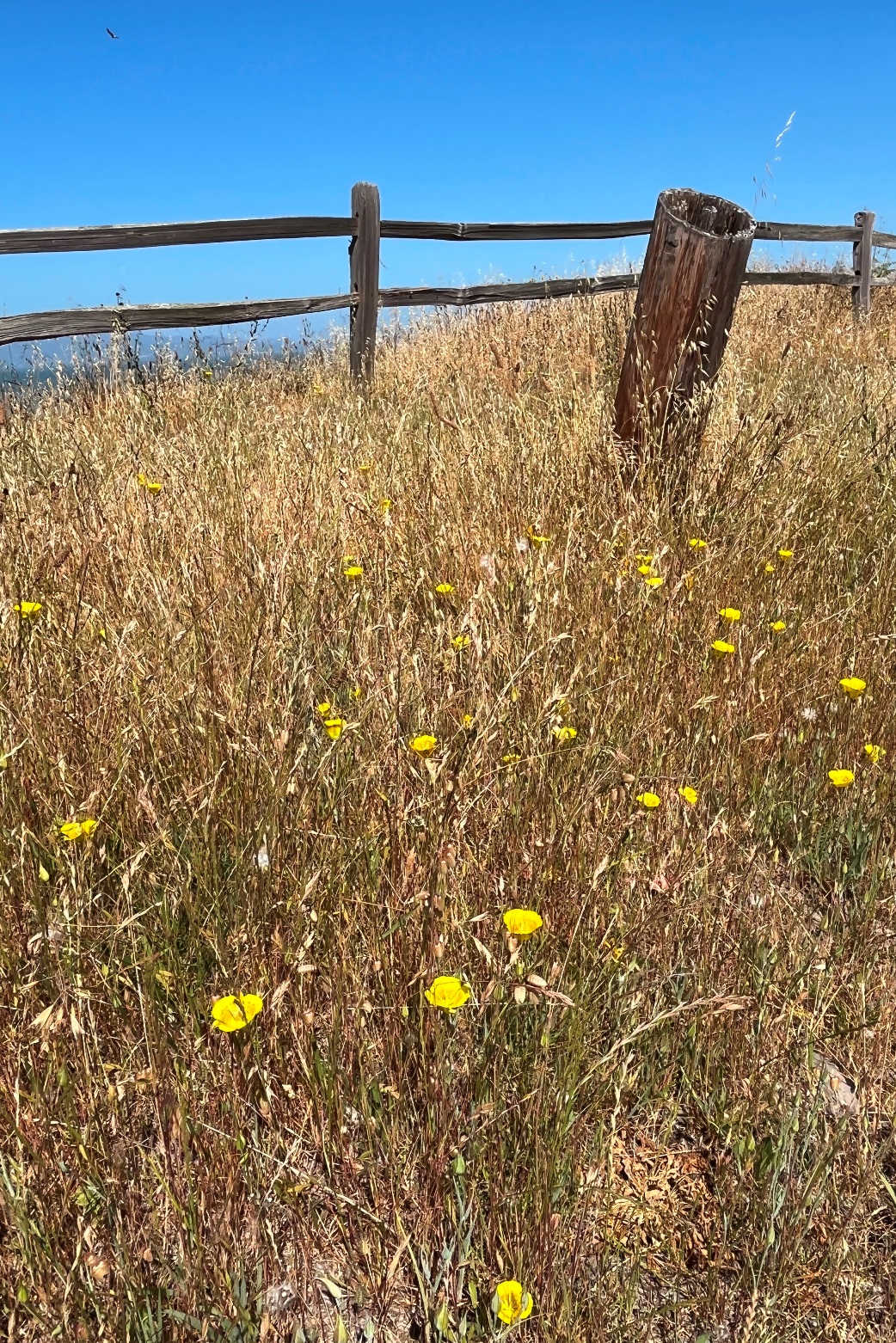
This was the usual hike in
Mitchell Canyon: out as far as the table under the huge oak and
then back. It was a beautiful autumn day, crisp, especially when
the wind blew, but sunny and filled with color and things both
animal and vegetable to look at. Just 8 of us on the 3.8 mile
hike.
It was interesting that there were no berries that we could find
on any of the Rhamnus ilicifolia (holly leaf redberry) or the
Frangula californica (coffeeberry) but plenty of toyon berries.
https://www.flickr.com/gp/momcat_ksw/Fm02pNkqGK
10/15 - No hike (rain)
10/08 - Huckleberry (I didn't hike)
10/01 - No hike (wet)

There were only five of us
today on a pleasant, cloudy day with a nice breeze and just a
scatter of fat rain drops. Quite a change from the upper 90's we
had yesterday. We walked a CCW figure 8 at Pacheco Marsh which
reopened last May after a major restoration project. There was
lots to look at and we felt sorry for those who had other calls on
their time.
https://www.flickr.com/gp/momcat_ksw/Cy146tY1Eu

It was an early fall-like day with lots of clouds and just the beginnings of autumn color here and there. We walked from the Castle Rock Recreation Area entrance to the gate into Mt Diablo State Park and back 3 miles.
9/3 - from the end of Springhill Rd.

https://www.flickr.com/gp/momcat_ksw/Dj230Q7pXp
08/27 - Briones

https://www.flickr.com/gp/momcat_ksw/eK9257460H


I really shouldn't have worried about the weather being too warm! The fog was thick to start the hike and still had not done more than lift a bit by the time we were finished. It was a drippy, gray morning, but it wasn't cold and the walk was worth it. Eleven of us made a CW loop from the Skyline parking area, out the East Ridge Tr to Prince Tr, down to Stream Tr and back up to the parking lot. 3 miles.
https://www.flickr.com/gp/momcat_ksw/9n4Y6P98PC

There is always a lot to look at at the "Bulb". This was a good choice on a day which was warm even along the Bay shore.
The buckwheats were in bloom at the native garden and we had a good deal of fun at the "marble run". As usual there was a good deal of commentary on the current political situation scattered through the "art".
I can't claim even two miles, tho some "devices" claim we walked that far.


In the fourteen years I've hiked with the Wednesday Walkers, we have started from the Whitecliff Trailhead five times (11/2011, 10/2012, 04/2015, 04/2016 and 03/2020) and in each case we walked a CCW circle; check the blog for picture links if you are interested.
This time we broke with tradition and walked clockwise. That was a very good choice.
The hike started with fog and ended with bright sunshine. The weather was perfect for walking and this route was one which wouldn't have been at all enjoyable in "normal" July weather. Everything is dry and the grass is high. No flowers except for a patch of Madia and way too much star thistle! There were lots of acorn woodpeckers and various other "bush birds". It was definitely not boring.
There were 13 of us on the hike of just under 3 miles.
https://www.flickr.com/gp/momcat_ksw/3785Aby270

There were eleven of us today on a foggy, drippy visit to Sibley. The weather was more like February than July. We walked CCW from the Skyline staging area, around Roundtop. In all the times I have been to Sibley I've never ventured down to the large labyrinth at the far east end of the loop. So today we did that. And on the way back we took the Overlook trail across and down the hill back to the parking lot. Not much more than 2 miles.
https://www.flickr.com/gp/momcat_ksw/R94h0J7WZk

There were 11 of us today on our first group hike in a month. We
made the 3 mile loop from Inspiration Pt.; down Meadows Canyon Tr,
along Wildcat Creek and up Curran Tr.
There was plenty to see and it was good to be together and back on the trails.
https://www.flickr.com/gp/momcat_ksw/0Kht78fZ41

6/15/2025 Arrival and getting settled
Chuck, Lee and Robin (Lee’s sister) went up Friday, the rest of us trickled in late Sunday afternoon, with Leslie (Lee and Chuck’s daughter) and Isabella (their grand-daughter) arriving late as they had driven all the way from San Diego.
John and Delia had cabin 4; Lee and Chuck were in Cabin 3 and our “dining room” was the space between the two cabins. Susan, Becki and Linda Verobik. shared Cabin 1 and the remaining 7 (Donita, Karen, Robin, Jennifer, Leslie, Isabella and Linda J.) filled all six lodge rooms. That makes 14 of us.
We had plenty of hors d’oeuvres and wine to precede the, by now, traditional first supper of soup and salad.
https://www.flickr.com/gp/momcat_ksw/AcL109Xe07
6/15/2025 Charity Valley
People met promptly at 8:30 to carpool to the trailhead and we were on the trail by 9. As usually happens the group spread out, forming and reforming smaller groups whose pace and interests matched. We agreed to meet at the “waterfall” and Chuck, Leslie and Isabella were soon out of sight, while the rest of us spent lots of time looking at plants along the way. John and Delia, Susan and Linda V. turned back before reaching the falls. Distance approximately 3.25 miles.
In spite of the early date and the elevation (roughly 7800’ per the USGS topo, tho phone apps registered higher) there was lots to see. The surprises were an increase in the number of peonies and masses of an uncertain species of Allium. Susan and Linda spent a good deal of time and think they finally id’d it.
Another good meal and camaraderie to end the day.
https://www.flickr.com/gp/momcat_ksw/GVHK5C9Lxs
6/17/2025 Meiss Col to hunt for Beckwith violets
8:30 found us loading into carpools and we were booted, slathered with mosquito repellant and sun screen and on the trail by 9.
It doesn’t matter how many times we walk this section of trail there is always lots to see and appreciate. This time there were also huge, persistent swarms of mosquitos which followed us until we finally got some strong breezes higher up.
It was early for the iris, there were plenty of buds, and a bit past the peony’s prime, but perfect timing for the violets!
When we had tired of looking at violets we retraced our steps and followed the posts up the western ridge to the rocky area we call the “flower garden”. Wonderful views, breezes to repel mosquitos and moderate the temperature, enough flowers to satisfy us – it would be hard to ask for more.
A bit over 5 miles (hard to calculate when we wandered about so) and the lunch spot was at over 9100’.
https://www.flickr.com/gp/momcat_ksw/zMGHb4071T
06/18/2025 from Schneiders Camp
The road into Schneiders was clear and we were lucky to have 3 vehicles with high enough clearance to brave the ruts. Again we were on the trail by 9.
The climb up to the ridge is always slow for many of us (we start at 8300’ and the ridge is 9100’) but there was lots to engage our attention. For lunch we went on north as far as the big log by the hemlocks with a view of Lake Tahoe. Chuck and Isabella, followed by Lee, Robin, Leslie, Linda J and Jennifer went further toward Showers Lake…just to look :-)
Again, mileage is approximate and altitude has to be considered; about 3 miles to the lunch spot and back with another half mile or more for the group which walked on toward showers. At least a mile of that was over 9000’ for everyone.
We had dinner reservation at the Caples Lodge restaurant. Karol and Will Robinson joined us, so there were two tables of 8. Very good food!!
https://www.flickr.com/gp/momcat_ksw/M41VJ61R29
06/19/2025 varied
John and Delia had to leave for home, Jennifer took Becki who had missed the Monday hike to to Charity Valley. Chuck tweaked his back and didn’t hike.
The rest of us divided into two groups. Lee, Leslie and Isabella started at Woods Lake and walked up to Winnemucca and then on to the spot where the trail descends to Round Top Lake. The rest of us took two cars to the pass parking lot and walked to Frog, around the lake, then made a short spur along the PCT to the base of Elephant’s Back before returning and continuing to Lake Winnemucca. The two groups met at Winnemucca. Several of the Frog group crossed the logs at the lake outlet and went hunting for the white heather (Cassiope mertensiana) and the Kalmia which Lee had seen. Robin joined the Woods group for the return and the rest of us retraced our steps (minus the walk around Frog Lk).
Again milage is approximate. For the Woods group a bit under 4 ½ miles; for the Frog group a bit over 6 ½ miles (with 1 ½ to 2 miles over 9000’)
We were all glad to get back! Supper was leftovers (you wouldn’t have guessed, there was so much good food).
https://www.flickr.com/gp/momcat_ksw/6130VuYRN4
Friday morning found us packing the cars and heading back to “civilization”.
That’s the story of the 2025 invasion of Caples Lake Resort by the “flower ladies” (and gentlemen).
Lee talked to Gwen and we are on the books for the week before 4th of July (6/28-7/3) 2026!!

It was cool to start, but we were grateful for the cool breeze off the fog as we climbed up the hill. There was plenty to look at: masses of monkeyflower and ocean spray with smaller things hiding below. Nine of us plus Murphy; a bit over 3.75 miles.
https://www.flickr.com/gp/momcat_ksw/7Es0k222T0
06/04 - Redwood Regional Park

It was a perfect morning for walking!! There were just 9 of us today doing the easy loop at Redwood RP. Starting from the Fish Ladder we made a clockwise loop out the Bridle Tr as far as the Fern Tr junction with Stream Tr (picnic tables and Digitalis) then back Stream Tr. There was a lot to look at so we were not very speedy. About 3 miles.
https://www.flickr.com/gp/momcat_ksw/1P4eDTK5p2
05/28 - Pacheco Marsh
I didn't walk...see Phred's Pictures: https://www.flickr.com/gp/phredspix/195a4o16o0
The forecast was for hot inland and temperate by the Bay, so we headed to Pt Pinole in search of Blue and Gold: Brodiaea elegans and Calochortus luteus. We were not disappointed, both were more abundant than we could recall having seen!!
We made a clockwise loop from the Atlas Rd entrance out to the coast and north to the pier, then back "owl alley". There were 11 of us on the 2.75+/- mile walk.
https://www.flickr.com/gp/momcat_ksw/6W0K084959


Jeanne's birthday isn't until the 16th, but this was the week a group of us joined her at High Hand Nursery Cafe in Loomis to celebrate. The time together was absolutely worth the drive.
https://www.flickr.com/gp/momcat_ksw/0NjD2770WW


There was a group of 16. It was beautiful day for hiking and Sunol is a wonderful place to be out on the trail. Blue sky and green everywhere with lots of flowers, birds and other wildlife, too. The route (a clockwise circle up Hayfield Road and down Indian Joe Creek) was just under 3.5 miles and it took us well over 4 hours, but there was a lunch stop! We must not let seven years go by before hiking there again.
https://www.flickr.com/gp/momcat_ksw/dX3g7230P6

There were 15 of us (and two dogs) on a bright, warm day. We walked a clockwise loop from the Montecito entrance: out Paradise Valley Tr, down Lime ridge Tr to Blue Oak Tr and back Ohlone Tr. Less than 3.5 miles
Some folks were moving faster than others and went ahead to find the labyrinth. They didn't go far enough and declared to the rest of us that there was "nothing to see, folks". I had a nagging feeling they were wrong, but we were all ready to head back to the cars and birthday cookies for Donita, so that's what we did. Checking google earth at home I found that the labyrinth is a bit further (about 220 yards) on Blue Oak Tr.
https://www.flickr.com/gp/momcat_ksw/824u1ksP5t

Ever since the atmospheric rivers several years ago, Brandon Trail has been closed due to a collapsed culvert. Finally the alerts on the East Bay RPD web site indicated that the trail is now only closed to horses, so that is where we went today.
Our Route was CW from the Bort Meadows staging area on Redwood Rd., out Grass Valley Rd to the stone bridge and back Brandon Tr. There were 13 of us on a perfect day after storms. We watched birds (quail, hawks, jays, wrentits, towhees and more) and butterflies as well as botanizing. It was a great outing!! Just over 3 miles.
https://www.flickr.com/gp/momcat_ksw/677Pc9099s

We walked a clockwise circle on a gray and windy day. The light was great for photography tho. The huge herd of goats doing fuel reduction brought lots of smiles.
We were too late for the red fritillary, altho there were faded remnants of bloom so we know they are still growing in the usual spot. 13 hikers and 3 dogs; under 3 miles.
https://www.flickr.com/gp/momcat_ksw/kYwRX5Lw2r


The weather forecast was so uncertain and the sky so gray that we stayed close to "home" today. Jennifer suggested Shell Ridge and that turned out to be an excellent choice.
We started from the Sutherland Dr entrance, walked east and then down the steep section to the pond, back up to Briones Rd, then east again and south to the junction with Indian Creek Trail which we took back to Fossil Hill. There was a good sized group (15 + 2 dogs). Enough of us wore rain jackets that the clouds were just dramatic and didn't get us wet. 2.5 miles
For those of you who remember the lavish displays of native wildflowers on the hillside just inside the gate, you will be as sad as we were to know that it is now fenced with restricted access. There had been too many careless people wandering thru the flowers, trampling plants, all for social media photo ops :-(
https://www.flickr.com/gp/momcat_ksw/393w852WEY

There were a dozen of us today
to celebrate Susan's birthday. It was a perfect day to for our
first visit to Mt Diablo in 2025...bright sky, mild temperature,
green grass...absolutely wonderful. The only downside was that the
manzanitas were through blooming, with only a few flowers
remaining here and there. The majority walked to Balancing Rock, a
few went on to the gate, some turned around earlier (so 3-4 miles,
depending on the individual). We all met at the picnic table
hidden under the oak for snacks and celebratory cookies.
https://www.flickr.com/gp/momcat_ksw/a60ER6oYpi

Pelicans headed to the far end of the reservoir
Most of us met at Pine Lane and walked along the EBMUD trail, scurried across Mt Diablo Blvd and trudged up the hill to the parking lot. We then walked a counter clockwise loop around the reservoir. Of course the mist wasn't serious until we reached the far end, when it made no difference which way we returned. It was never really rain, but we still got plenty damp. 11 hikers and Sunny. The full route was about 4 miles.


14 of us started from the
parking area at the intersection of Grizzly Peak and Centennial Dr
on a very chilly morning (still in the 40s). We walked down the
canyon and then back up to the Botanical Garden for the current
art exhibit in the "Plants Illustrated" series. Three more of our
group joined us for the exhibit. After lunch/snacks on the deck we
squeezed into 3 cars to shuttle back to the top. A lovely day. 4.4
miles.
https://www.flickr.com/gp/momcat_ksw/01TPuSGHrN

There was a very large group today - 17* plus 2 dogs. It was quite chilly to start, especially in the shade or when a swirl of wind came through. The trail wasn't muddy and the Dirca, Oso Berry and white flowered Ribes were all in bloom. (spoiler...my Dirca photos were too "fuzzy" to post). A wonderful hike. 2.3-2.6 miles depending on return route.
It was special for Ann as her first hike with us was last February at Crockett Hills.
* I originally said 16, but had neglected to count myself.
https://www.flickr.com/gp/momcat_ksw/246ss4E095

For our first walk of 2025, eight
of us took a route we've not done since 2021, walking from the Skyline
gate to Redwood RP, along the Huckleberry path to Huckleberry Regional
Preserve. We had our snacks at the picnic tables there, then continued a
CW circuit along lower Huckleberry Path, then the Skyline Tr and so
back to the cars. 3.5 miles.
It is a bit tricky to navigate as neither the Huckleberry map nor the
Redwood RP map shows the connection, tho each has an arrow to the
other. However it is very clear on a 1991 map I have (Trails of the East Bay Hills, Central Section,
published by Olmsted Map Co-Berkeley). The connection from the East
Ridge Tr in Redwood has badges for the East Bay Skyline Tr, the Bay Area
Ridge Tr, and the DeAnza Tr, but no mention of Huckleberry Preserve.
This is one you have to know exists!
https://www.flickr.com/gp/momcat_ksw/3Wgy9Nt7n2