Wednesday, December 18, 2024

12/18 - Sobrante Ridge Preserve


For our final hike of 2024, 9 of us hiked from the end of Coach Dr up and around to the Sobrante Ridge Preserve manzanita grove and back. We started in dense fog and the hike ended in sunshine. 2.6 miles

https://www.flickr.com/gp/momcat_ksw/0j0ZDrc536

12/11 - Holiday Luncheon


Counting our hosts Ron and Sylvia, there were 20 Wednesday Walkers today as we celebrated another year of friendship. Eight of us took a brief 1 mile walk along Turtle Creek before returning to stuff ourselves with all sorts of goodies.

https://www.flickr.com/gp/momcat_ksw/T18922k2Vs


Wednesday, December 4, 2024

11/13, 11/27 and 12/04

 12/04 - Vaca Creek/Almond Ranch


There were a dozen of us today, taking advantage of dry sunny weather as we walked from the EBRPD parking lot on Alhambra Valley Rd up the Vaca Creek Tr to the Ridge Tr and the Almond Ranch property. It was hazy, but green is starting to show and it was a good morning to be out and moving. The highlight was the spotting of what we decided was a golden eagle sitting in the top of a tree.  3.5 miles

https://www.flickr.com/gp/momcat_ksw/6X55Vga14x


11/27 - Cesar Chavez Park, Berkeley 


This was the perfect day to walk along the Bay. We went, for the first time, to Cesar Chavez park near the Berkeley Marina at the foot of University Ave. It was clear and bright after our storms, and the main trails are paved or gravel and not muddy. We enjoyed snooping in one of the areas undergoing ecological restoration. Elaine and Delia know people involved with the project. Only a bit over 1.5 miles but just right for the day before Thanksgiving.

https://www.flickr.com/gp/momcat_ksw/2T416bP0V8


11/13 -  UC Botanical Garden

We started with the exhibit of the Florigeum being created for the garden; this is the 3rd exhibit and includes 75 illustrations both new and from the previous exhibits. Lee gave an overview of the project and the displayed art work. Then some of us walked in the garden including the newly reopened Tropical house.

The sky was clear when we arrived, but getting quite gray as we left the Julia Morgan Building and the first spritz of rain hit the windshield as we drove home. Excellent timing!!

https://www.flickr.com/gp/momcat_ksw/F9s87Kd9Y0


Thursday, November 7, 2024

11/06 - Briones


We were lucky that EBRPD posted warnings, but did not close the park because of the high wind and red flag fire warnings. 8 of us walked from the far parking lot at the Bear Creek entrance to Briones, out to the archery range, up and over the crest and down Yerba Buena Tr. to Valley Tr, then Old Briones Rd back to the cars. just under 3.5 miles. Then we drove over to the other parking lot and enjoyed snacks (Elaine had chocolate to share) and watched wildlife, two separate coyotes and a great blue heron.

This is only the 2nd time I know that we have walked the Yerba Buena Trail.  The prior time we went up from Valley Tr and down the steep Crescent Ridge Tr. I had no desire to do that again, so this time we walked up the south side of the ridge behind the archery range and the down Yerba Buena.

https://www.flickr.com/gp/momcat_ksw/hQ8062g3kG


Thursday, October 31, 2024

10/30 - Mitchell Canyon


There were a dozen of us today on a wonderful autumn day. It was chilly at the start and we didn't see any tarantulas. The grapes were not yet in full color, but beautiful none the less. We got our wildlife "fix" near the end of the hike as we watched a bobcat. 4 miles.

https://www.flickr.com/gp/momcat_ksw/q30dm4e398

Wednesday, October 23, 2024

11/23 - WCOS from Borges Ranch


Eleven of us started NE up Costanoan Tr as far as the bench where we stop when coming S from Ginder Gap. There we went thru the gate and took the single track Ridge Tr back toward the south. Ridge Tr joins the Briones/Mt Diablo Tr about 2/10 of a mile before the junction with the Borges Ranch Tr. We turned slightly west at that junction and followed the road south, past the ponds, and back up hill as far as Stonegate Tr. where we rejoined the Briones/Mt Diablo Tr for the return to Borges Ranch. About 3.4 miles

A beautiful autumn day!! We started with long sleeves and took off layers as the day warmed. At the end of the hike we enjoyed the shaded picnic area and the treats Delia and Daniella brought to share.

https://www.flickr.com/gp/momcat_ksw/3i838R3302


Wednesday, October 16, 2024

10/16 - Fernandez Ranch


There were eleven of us hiking today at Fernandez Ranch even tho most of us had a few drops of rain at home. The sky was gray but it didn't rain; a very good day to be out walking. We went out Windmill Tr, getting the nasty hill out of the way to start with. Then WNW on the segment of the Bay Area Ridge Trail and finally circling back on the aptly named Woodland Tr to rejoin Windmill Tr.  about 3.5 miles

https://www.flickr.com/gp/momcat_ksw/T0b880Q7gk


Thursday, October 10, 2024

10/09 - Dotson Marsh at Pt Pinole (plus 9/11 to 10/2)


After way too many days of 100°+ weather, the fog was finally back on the Bay side of the hills!! Eight of us walked the usual route from the old Giant Hwy parking lot to the spit and back (under 2.5 miles) and were very glad to be out and moving in the fresh air; long sleeves and jackets seemed strange but welcome.

There was talk of what the historic shoreline might have been, so you will get some snips of old maps to help visualize the changes as well as the usual hike pictures. The old topo maps from HISTOPO at UC Berkeley helped a lot (https://guides.lib.berkeley.edu/histopo).

https://www.flickr.com/gp/momcat_ksw/8Xe2WC27N4


10/02 - no hike, extreme heat

09/25 - no hike, walkers too busy

09/18 - West Ridge, Redwood Regional Park


Nine of us walked from the Redwood Regional Park Skyline Gate to the Chabot Space and Science Center and back on a very foggy morning. This was the walk originally planned for last week. The consensus was that we really ought to do this more often than once every 10 years! There was a lot to look at. It is likely very crowded on weekends and there were quite a few dogs. We were treated to more of Jennifer's grapes when we got back to the cars. Just over 3.5 miles

https://www.flickr.com/gp/momcat_ksw/70s2tj1qb2


09/11 - Pine Canyon
 
A major accident on Hwy 24 westbound at Hwy 13 completely shut down the road. It was a truck carrying sod which ended up all over the freeway. Traffic was backed up thru Lafayette and the radio traffic reports were even suggesting Canyon as an alternative (so much for our "secret" back roads) which turned surface streets into solid lines of cars. 
 
The original plan had been to walk from Redwood to the Chabot observatory and back, but Pine Canyon was a fine alternative. There was a pleasant breeze with a cool undercurrent and the trail is mostly shaded, too. It is definitely feeling like fall with gold hills and lots of acorns on the trail; the grape vines are mostly green, but here and there a few leaves are showing color. 10 of us enjoyed the short, under 3 miles, walk. We meandered rather than hiked, enjoyed chatting AND Susan and Elaine brought cookies. It was an all together special day.

https://www.flickr.com/gp/momcat_ksw/22309svr9c


Thursday, August 29, 2024

08/28 - Huckleberry


The shade was welcome as 8 of us made the clockwise loop at Huckleberry Preserve starting from the Skyline entrance. It was 94 when I got home just before 1. The hike is under 2 miles, but certainly seemed longer. Jennifer brought grapes from her garden and we enjoyed them as a treat at the end of the walk.

https://www.flickr.com/gp/momcat_ksw/349we625xE

Wednesday, August 14, 2024

08/14 - South Shore Briones Reservoir


12 of us walked from the Bear Creek staging area to the dam overlook parking lot. It was a warm day and we were glad of the shade. This is such a botanically rich area that it took us about 2 1/2 hours to go a bit over 3.5 miles. There was a driver shuttle back to the start.

https://www.flickr.com/gp/momcat_ksw/4918WJ22bH for pictures.

A bit of history: The reservoir is impounded by Briones Dam, an earthen dam completed in 1964 (60 years ago). The reservoir is the largest of EBMUD's five East Bay terminal reservoirs, with a total capacity of 60,510 acre⋅ft, and it has a total watershed of 8.59 square miles. 

Wednesday, August 7, 2024

08/07 - Sibley


Flexibility is important when the weather doesn't match the forecast. It was already over 80 by the time 10 of us met at the Old Tunnel Rd parking area. The long up hill in the open grasslands really held no appeal. So we decided to make this an up and back along the shady Round Top Creek trail. That was a good choice! We met at the picnic tables by the main parking lot for snacks and group chatter and then headed back down. We were back to the cars shortly after 11:30. My car thermometer reached 90 on the drive home. 3.5 miles

https://www.flickr.com/gp/momcat_ksw/1z5Cm5e6JX


07/31 - Marina Bay

I did not hike...Susan sent this report.

Ten Wednesday Walkers had a foggy, cool and breezy walk along the San Francisco Bay Trail this morning and a wonderful visit to Rosie The Riveter National Park. The docents shared information about the Home Front war effort, the shipyards, the Ford Assembly Plant for jeeps and tanks and we saw a terrific movie about the Rosies' contributions to the winning effort during WW II. Hearing their stories is quite moving. A quote from one of the welder Rosies, "I live in pants and ugly shoes, leather jacket, big mittens, goggles and a monster hood, fire coming out of my hands. I did it!". We encourage you all to make a visit to the museum.

The walk was about 4 miles, everyone in our car had a slightly different distance and number of steps on our phones, and I'm not as adept as Karen at measuring distances on the computer. Phred and Lisa will be putting photos up when they can.


Friday, July 19, 2024

07/17 - Carquinez Regional Shoreline


We headed Bay side with hope of cool breezes. Meeting at the Bull Valley staging area on Carquinez Scenic Dr west of Port Costa we walked a CW loop to the town and back. It has been almost exactly 5 years (7/31/19) since we walked this loop, altho we tried last September but the area was closed then. There was a fire (6-23-22) which burned over 120 acres including a large portion of the eucalyptus on the water side of the hills. They were clearing those burned trees last September. It was a good, if short, walk of under 2.5 miles and the weather was about perfect!

https://www.flickr.com/gp/momcat_ksw/xefWaA8963


 06/26 Kings Canyon Tr from Valle Vista

After a week of hot weather, the fog was back this morning and hikers were digging for extra layers. Nine of us walked an out and back route of about 4.5 miles starting from the Valle Vista staging area and heading south along the Kings Canyon Tr. The water level is still high in the reservoir and things are surprisingly green in spite of the heat wave.

https://www.flickr.com/gp/momcat_ksw/G4175Vr2v2

Caples Week 08-11 July


There were 7-8 of us this year with many of the usual cast missing. Chuck was alone in cabin 3 as Lee is off to Virginia with a fellowship to a interdisciplinary program at the Mellon estate sponsored by the Oak Spring Garden Foundation. John and Delia stayed in cabin 4. Donita, Linda, Jennifer and I had rooms in the lodge and Susan came for just Wednesday and Thursday, staying in cabin 1.

07-8     Old Hwy 88
We took nearly 4 hours to walk the 2 miles. There was so much to see!!
https://www.flickr.com/gp/momcat_ksw/8vTaWCoq61

07-09     from Schneiders to the Ridge
Because we had only one high clearance vehicle, we parked before the last downhill section to the trailhead and walked that extra quarter mile. Other wise it was very much as we have done in previous years. Up to the ridge and then north so we got a view of Tahoe and (this time) Showers Lake. About 3.5 miles
https://www.flickr.com/gp/momcat_ksw/k105D0R000

07-10     Carson Pass to Meiss Col and beyond
This was the usual walk plus wander; mileage was at least 4 trail miles but add more for wandering about. 
https://www.flickr.com/gp/momcat_ksw/0r279Cb6K4

07-11     Woods-Winnemucca-Roundtop Lk- Lost Cabin Mine Tr
Up to Winnemucca, then just a bit further to find the Marsh marigolds, heather and Sierra primrose. Right! We ended up at Roundtop Lake and then went down Lost Cabin Mine Tr.  4 1/2 miles by trail, but, again,  LOTS of wandering.
https://www.flickr.com/gp/momcat_ksw/qp6u3q6PKg

Miscellaneous at CLR
https://www.flickr.com/gp/momcat_ksw/Q45v07Z275

And if you need a juniper fix

Wednesday, June 19, 2024

6/19 - Sibley (Alder Creek)


Ever since the East Bay Regional Park District celebrated the grand opening of the Alder Creek and Leatherwood Creek Restoration Project at Sibley Volcanic Regional Preserve in late May we have been anxious to explore the area. We walked there in January 2018 (https://www.flickr.com/gp/momcat_ksw/4mtYxo for pictures) shortly after it was first opened to the public. But is quite different now with about a half a mile of previously culverted creek opened and restored to more natural conditions.


The weather was great today as a baker's dozen of us walked clockwise starting from the Pinehurst/Eastport Staging Area. Ninebark Tr, Alder Creek Nature Tr, then Gudde Ridge Tr up to the ridge to join the McCosker Loop Tr. This was the reverse of the loop we walked in 2018. Only 2.5 miles, but a good up and down workout.

There is lots of information on the project and links to a video on the EPRPD website if you are interested:
https://www.ebparks.org/projects/sibley-alder-and-leatherwood-creek-restoration-and-public-access-project-mccosker-project
(scroll down to near the bottom to see the videos of how the creek handled the Dec 2022 atmospheric river event.

Friday, June 14, 2024

06/12 - Briones


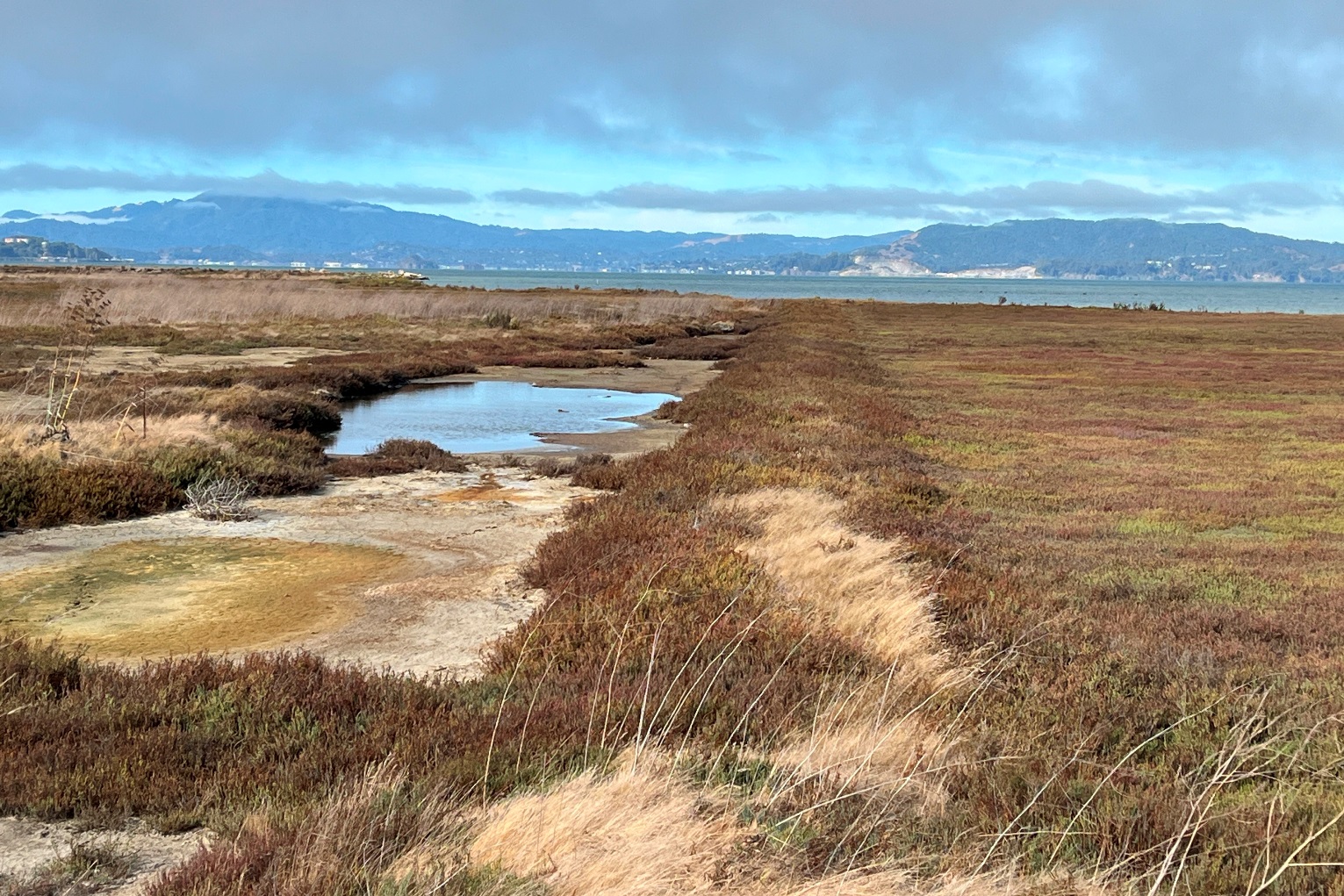
After no walk last week because of temperatures in the upper 90's, 8 of us took advantage of cooler weather and walked from the Alhambra Valley Rd entrance up Toyon Canyon and back. It included more up than we remembered. At least there was shade and an occasional breeze. Things are drying fast, tho there was still a bit of water in the creek. Returning to the cars we found that the bridge over the creek has finally (I found pictures from 2019 with a "closed" sign) been repaired. Under 2.5 miles.

https://www.flickr.com/gp/momcat_ksw/jPBL5KngGB


06/05 - No hike, temperatures in the high 90's


05/29 - Redwood RP


It was a large group (15) today. We started together from the Fish Ladder but soon separated into smaller groups, botonizers, bird watchers and just plain walkers. We walked west on Bridle Tr and joined Stream Tr at Chown, going further up the canyon to the picnic tables by the Fern Tr junction for snacks and more birthday time for Ulla. Return was via Stream Tr. Just under 3 miles (but see below).

https://www.flickr.com/gp/momcat_ksw/wmfc8B4hks

That only tells part of the story. Splitting into smaller groups is fine as long as everyone knows where we are going and people rejoin the group at trail junctions. Unfortunately, we learned that lesson the hard way today as one hiker turned left when the correct turn was to the right. Each of the other groups thought she was with another group, so it wasn't until we returned to the cars that the truth of the situation sank in. All's well that ends well, the lost one returned on her own and the ones who set out to hunt for her eventually did as well. The whole situation was made worse by a total lack of cell coverage. Mileage for the lost and the seekers was double (or more) that of the main group.

Friday, May 24, 2024

5/22 - Pt Pinole


11 of us enjoyed the warm sun and mild breezes of Pt Pinole. We started from the Atlas Rd entrance and made a CW loop of 2.6 miles (3 mi or so for those who walked out the pier). There was still green grass and there were the hoped for Calochortus and Brodiaea along the Bay View Trail just before starting down to the pier.

https://www.flickr.com/gp/momcat_ksw/U5P80999Fi

5/15 - no hike. A dozen of us drove to Loomis to help Jeanne celebrate her 95th birthday with lunch at High Hand.


Friday, May 10, 2024

05/08 - Mt Wanda


On a day which promised to get very warm, eleven of us walked at Mt Wanda. It was the first time the group had visited since 2019 (the JMLT hike to introduce the Almond Ranch property). We walked up the fire road, then returned via the Nature Trail. There were LOTS of birds. After returning to the parking area we went the short distance to the John Muir Historic Site to enjoy the native garden at the visitor center where Elaine has spent so much time and effort. About 2.5 miles.

https://www.flickr.com/gp/momcat_ksw/a39q4qeu9B

Wednesday, May 1, 2024

05/01 - Perkins Canyon


There were 10 of us today. The weather forecast was for quite warm, but this is a short walk (under 2 miles) and there is a good deal of at least partial shade. Crossing the first creek was rather messy, but all the other creek crossings were easy in comparison. The flower of the day was the Diablo fairy lantern (there were so many we almost began to ignore them) followed closely by Triteleia laxa. The excitement was a large rattler which had been sunning in the middle of the fire road. He left without showing any interest in the humans, thank goodness.


https://www.flickr.com/gp/momcat_ksw/uv5akudN42

Wednesday, April 24, 2024

04/24 - Fernandez Ranch


There were a dozen hikers with two dogs today at Fernandez Ranch. It was a mild, gray day, perfect for walking. The clouds gave the light a special quality which intensified the green of the hills and the many colors in the flowers. We went CCW up Windmill Tr to the top of the steep hill, then SE along Woodrat to Whipsnake, east to Black Phebe and then NW back to the start. 3.5 miles

https://www.flickr.com/gp/momcat_ksw/e8L963LGfP

Wednesday, April 17, 2024

04/17 - Ring Mt.


Eight of us had a good walk among the flowers of the Ring Mt Preserve. We started from the Westward Dr trailhead, went up the Phyllis Ellman Trail, made the loop around petroglyph rock, went up the steep trail to Turtle Rock, then up the fire road, past the water tank, to the area where we sometimes see the red silene (too early this time). The return went down the fire road, along a bit of the Ellman trail and then off across the meadow and down along the trees to the small creek crossing. We not only saw flowers, there was wildlife, too: deer, a coyote and a very long garter snake!  Under 3 miles.

https://www.flickr.com/gp/momcat_ksw/8Bnz1h3770

Wednesday, April 10, 2024

04/10 - Skyline Gardens


There were 11 of us walking the Skyline Gardens trail today. With the trail from Fish Ranch to the Sibley parking area at the end of Old Tunnel Rd still closed, we made it an out and back from the Steam Trains parking area to the picnic table near the EBMUD water tank. That short 2 miles took us nearly 3 hours there was so much to see.

https://www.flickr.com/gp/momcat_ksw/97V5665qji


Wednesday, April 3, 2024

04/03 - Mt Diablo (Back and Donner Canyons)


There were a baker's dozen of us on a beautiful spring day on Mt Diablo. We started from the end of Mountaire Pkwy and walked a CCW loop: the single track up the hill to the right after the entrance gate, then Back Creek Tr up the canyon to Tickwood Trail, we stopped for a snack at the junction with Donner Canyon Rd. Then the group split with Lee, Susan, Geoff, Polly and Becki taking the Heatherington Trail down and the rest of us going directly down Donner Canyon Rd. Distances ranged from just under 3 miles to almost 3 1/2 miles.

https://www.flickr.com/gp/momcat_ksw/HQcY2F7TvT

3/27 - Lime Ridge


13 of us plus Sunny took a chance on finishing our hike before it rained. Lime Ridge was the close to home choice. We did the familiar CW loop from the Montecito Drive entrance (out Paradise Valley Tr to the 5-point junction, down Lime ridge Tr to Buckeye Tr and back via Oursan ) It was gray, but no rain for the walk. The loop is almost exactly 3 miles and thru a variety of habitats. The oak woodland section along the south side of the ridge was a real surprise to the new hikers who had only driven along Ygnacio Valley Rd. Then there is a bit of chamise and more oak woodland, a few stock ponds and finally the open grassland. Lots of green. 

https://www.flickr.com/gp/momcat_ksw/30o2s328oa

Wednesday, March 20, 2024

3/20 - Rockville Hills


15 of us today!!! Another absolutely beautiful day to be out on the trails. We made a clockwise loop starting from the parking lot on Rockville Rd.; up the hill to the restrooms near the small pond, then NW to Gray Goose Lake where we stopped for a snack. We took May-December Trail north to join the Rock Garden Tr. A single track led us east to join the Bay Area Ridge Tr. The last leg was Lower Quarry Tr. Lots of flowers including one lonely Red Fritillary. Under 3 miles. 

https://www.flickr.com/gp/momcat_ksw/zfc3o534qS

Friday, March 15, 2024

03/13 - Black Diamond Mines


There were 11 of us today on a glorious hiking day. After what seemed like continuous storms for the last two weeks, the day was clear, the sun was warm and the wind had a bite to it. The early flowers were nearly gone, but we saw plenty of others. For the first time this year I took over 100 photos; no, I didn't post all of them! We walked more or less together until we reached the Manhattan Canyon bridge on the return. Then most headed down the east side of the canyon; Linda, Lee and Karen went up the hill after crossing the bridge and then followed the west side of the canyon. Neither was a long hike (2.5 for the shorter loop and not quite 3 for the longer).

https://www.flickr.com/gp/momcat_ksw/96z05a53mp


Monday, February 26, 2024

02/21/2024 - Arrowhead Marsh


There was a big group today: 16!!

We started from the parking lot by the King Fisher picnic area and most walked as far as the art installation at Zhone Way. Returns were staggered with some of us taking the long way around the New Marsh area, some returning as we had started, some waling along the road from the furthest in parking area...Lots of clouds and there was definitely rain on the west side of the Bay, but we were dry.

The tide was in, so birds were mostly floating out of range of my phone camera. Distances varied from under 3 to almost 4 miles.


https://www.flickr.com/gp/momcat_ksw/c2X6A5H60N

Thursday, February 15, 2024

2/14 - Crockett Hills


We had missed two Wednesdays because of ill timed rain, so really wanted to get out and check the beginnings of spring. It was 9:33 when 9 of us left the parking lot. The sky was gray, but the forecast insisted it would start to rain after noon. We found the Dirca in the usual spot and several patches of osoberry. And fungi...all sorts and everywhere. As we hit the parking area on our return, just a few minutes before noon, fat rain drops started peppering the pavement. Excellent timing! A bit over 2 1/4 miles.

https://www.flickr.com/gp/momcat_ksw/3E9dRf71WZ

Wednesday, January 24, 2024

1/24 - UC Botanical Garden


Lee was our docent for the 15th Anniversary Plants Illustrated exhibit (Edible California Native Plants) at Julia Morgan Hall. There are few pictures from the exhibit as the reflections on the glass were difficult to avoid. There were some very interesting pieces. Lucky for me one I really liked was not for sale!

There were 13 of us on a very drippy morning. The real rain stopped and it was good to be able to wander in the garden for a while after looking at the art exhibit. There is no map as few of us walked the same way.

Thursday, January 18, 2024

1/17 - Mulholland Ridge


There were 11 of us this morning. We all felt the need to get out and move, but not for too long or on a slippy, muddy trail. The Mulholland Ridge out and back with a circle around the knoll by the EBMUD tank fit the bill. Still too many clouds for great views but satisfying, none the less, with plenty of green and a very loud frog chorus in the valley with the ponds. Under 2 miles

https://www.flickr.com/gp/momcat_ksw/NjzfuprJ70

A reprise of the information about the name:

Quoting from Moraga's Pride, Rancho Laguna de los Palos Colorados (Moraga Historical Society, 2002) p. 95

Living on the east side of the summit of today's Rheem Boulevard, [John] Mulholand rented his land in 1873. Official documents show that he came from Ireland and was naturalized in San Francisco on August 31, 1867, when he was 59 years old. He was a member of the Willow Spring School Board in 1871 and again in 1892. He and his wife Ellen, who was born in 1840, had nine children. ... His will was probated in 1900. Ellen died  October 17, 1921.

However, Mulholland Ridge is not named for John, but for William Mulholland the same fellow responsible for the LA Aqueduct which drained Owens Lake. His name is associated with a formation which is evident in the geology of the ridge.


Wednesday, January 10, 2024

1/10 - Carquinez Regional Shoreline


Just 6 of us on an off and on rainy morning. There were several rainbows, but not bright enough to show in photos. There were views and plenty of growing things. Not too cold. And Elaine brought cookies to celebrate Phred's upcoming birthday. An out and back of about 3.25 miles

https://www.flickr.com/gp/momcat_ksw/5i5j8HZiCi

Wednesday, January 3, 2024

01/03 - Nimitz from Inspiration Point


5 of us walked from Inspiration Pt to the Peace Grove trail junction and back; 3.6 miles. It was beautiful after the rain: wonderful clouds, lots of green and new growing things. A good way to start the year!

https://www.flickr.com/gp/momcat_ksw/A8LawzBN38